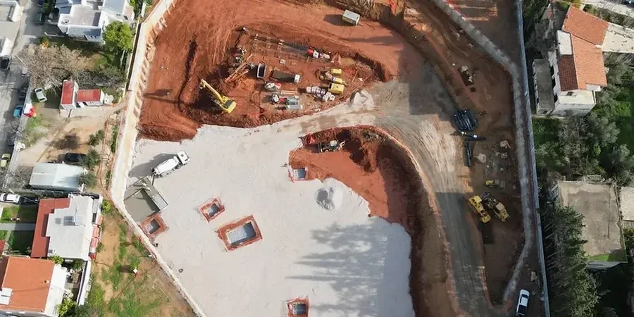
Nanaimo sits at a low elevation along the Strait of Georgia, where post-glacial marine sediments and compact till create a challenging subsurface for any project going more than 4 metres down. The city’s 2021 population of nearly 100,000 continues to push development into hillside lots and downtown infill sites, making deep excavation design a critical step before shoring ever begins. In our experience, a desk study is never enough here. You need borings that reach well below the proposed base, clear identification of groundwater perched within the colluvium, and a design approach that accounts for the stiff Vashon till that can fool a contractor into thinking the ground is uniform. We combine field data from methods like CPT testing with laboratory strength parameters to define lateral earth pressures that reflect actual conditions, not textbook assumptions. The result is a shoring design that works with the local geology, whether the excavation is for a parkade in the Old City Quarter or a slope-side foundation near Departure Bay.
Deep excavation design in Nanaimo isn't about applying a generic factor of safety. It's about predicting how the till, clay, and fractured rock will interact once dewatering begins.
Technical details of the service in Nanaimo
Risks and considerations in Nanaimo
A persistent error we see in the region is designing a shoring wall based solely on SPT blow counts without running a consolidated-undrained triaxial on the silty clay till. Contractors assume the grey, hard-looking till will stand vertically for weeks, but when October rains saturate the upper weathered zone, the apparent cohesion drops and the wall begins to creep. In Nanaimo, where the average annual precipitation exceeds 1,100 mm, this scenario is not rare. The consequence is not just a serviceability issue; it translates into measurable settlement behind the wall, threatening adjacent foundations. A second common misstep is ignoring the influence of a rising tide on groundwater levels near the waterfront. A design that works at low tide can become critically under-designed at high tide, especially in the coarse granular fills found along the harbour. Proper design anchors the lower portion of the model in a transient seepage analysis, not a steady-state average.
Our services
Our technical scope for deep excavations in Nanaimo moves from field characterization straight into numerical modeling and construction-phase support. We do not hand off a report and walk away. The city’s regulatory environment requires a sealed design that demonstrates compliance with the BC Building Code and WorkSafeBC excavation safety orders.
Shoring and Bracing Design
We develop detailed plans for soldier pile walls, secant piles, or soil nail systems. The design package includes lateral earth pressure diagrams, structural calcs for walers and struts, and a dewatering sequence specific to Nanaimo’s perched and regional aquifers.
Construction-Phase Monitoring and Review
We provide site review during critical excavation stages and install inclinometers, piezometers, and survey targets. Weekly reports compare actual wall movement against the design thresholds, giving the contractor and owner early warning of any deviation.
Quick answers
What is the typical cost range for a deep excavation design package in Nanaimo?
For a typical commercial excavation between 4 and 8 metres deep, the full design package including borings, laboratory testing, shoring calculations, and sealed drawings generally falls between CA$2,720 and CA$13,050 depending on the complexity of the soil profile, the proximity of adjacent structures, and the number of support levels required. Projects with complex groundwater conditions or seismic analysis needs will be at the upper end of that range.
How far from the excavation face must we monitor for settlement?
The zone of influence depends on the soil type and support stiffness, but in Nanaimo’s typical glacial till, we recommend monitoring points extending a distance equal to at least twice the excavation depth behind the wall. In softer river-deposited clays near the Nanaimo River, that zone can extend to three times the depth.
Can we use an open-cut slope instead of a shored wall?
In some upland sites with competent sandstone bedrock and sufficient right-of-way, a sloped excavation may be feasible. However, most urban sites in Nanaimo lack the space, and the till’s fissile nature makes steep cuts risky. We evaluate the global stability of any proposed slope using limit equilibrium methods before approving an open cut.
What seismic parameters do you use for the Nanaimo area?
We extract the spectral acceleration values directly from the 2020 NBCC seismic hazard tool for the specific coordinates of the site. For much of Nanaimo, the design ground motion reflects contributions from both shallow crustal earthquakes and the deeper Cascadia subduction interface, which often governs the long-period response of taller retaining structures.